A method used for this process is shown below. Using an index in Volume I, Cavaliers and Pioneers, Abstracts of Virginia Land Patents and Grants 1623 - 66, by Nugent was used to outline the names of rivers, streams, creeks, swamps, etc., as they appear alphabetically in the index.
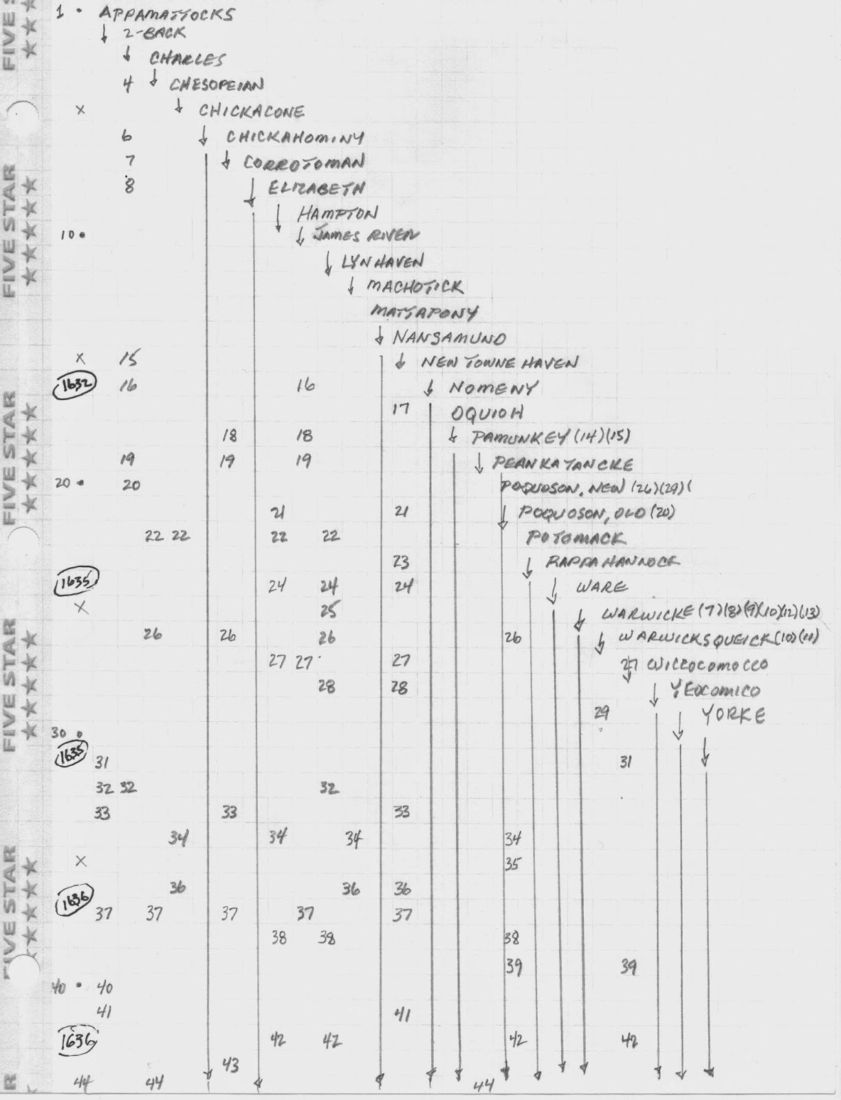
From left to right, it shows the names of rivers as they are indexed, with the page number that they are recorded falling below. Dates were then placed along the left hand margin as they appear in the surveys. This gives a rough chronology of the "rivers" as they become involved with a survey. For example, the river named "Wiccocomocco" does not appear until 1635. [p.27] The river "Nansamund" is involved in a survey before 1632. [p.17] If an ancestor uses these rivers as landmarks for their patent, you can place these ancestors in an appropriate chronology. Often, two to three years difference may break one of those brick walls.
No comments:
Post a Comment